Population Increase:
The planned population growth for Portlaw between 2016 and 2031 is 250 people. This in my view, combined with the aspiration of the village to grow and become a hub for...
Map 2: Settlement and Zoning map
Dúnta18 Mei, 2021, 11:00am - 30 Lún, 2021, 5:00pm
Map 2: Settlement and Zoning Map
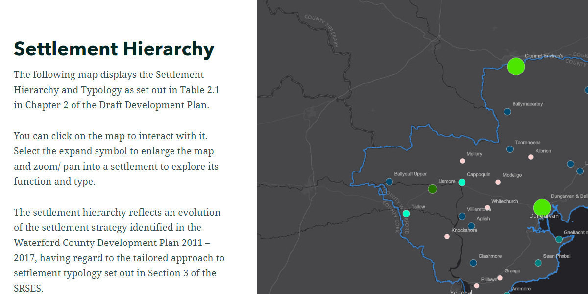
This map shows Waterford Settlement Hierarchy Map. The data contained in the map is as follows:
- Settlements Hierarchy;
- Settlement Boundaries;
- Land Use Zoning and Flood Zone; and
- Specific Development Objectives.
Click here to view map
Clár ábhair
Observations
Observations
[redacted text] owns lands in the immediate Killea village area. These lands are Folio no. WD28968F currently zoned village centre and residential medium density.
[...
On behalf of Mr Sean Johnston and in reference to the above site, please find below submission for lands to be included as part of the rezoning
Mr Sean Johnston wishes to have existing...
A Chara,
Noel Frisby Construction Ltd would like to make the following submission to the Waterford City & County Development Plan Review on foot of the publication of the Draft City...