Section 9.0 Other Development Considerations
9.1 Ribbon Development
Dwellings which give rise to or exacerbate an existing pattern of ribbon development shall generally not be permitted. Ribbon development is defined as where 5 or more houses exist on any one side of a given 250 metres of road frontage[1].
Please refer to Policy Objective H29 within Volume 1: Section 7.11.4 for special considerations in this regard.
9.2 Site Boundaries
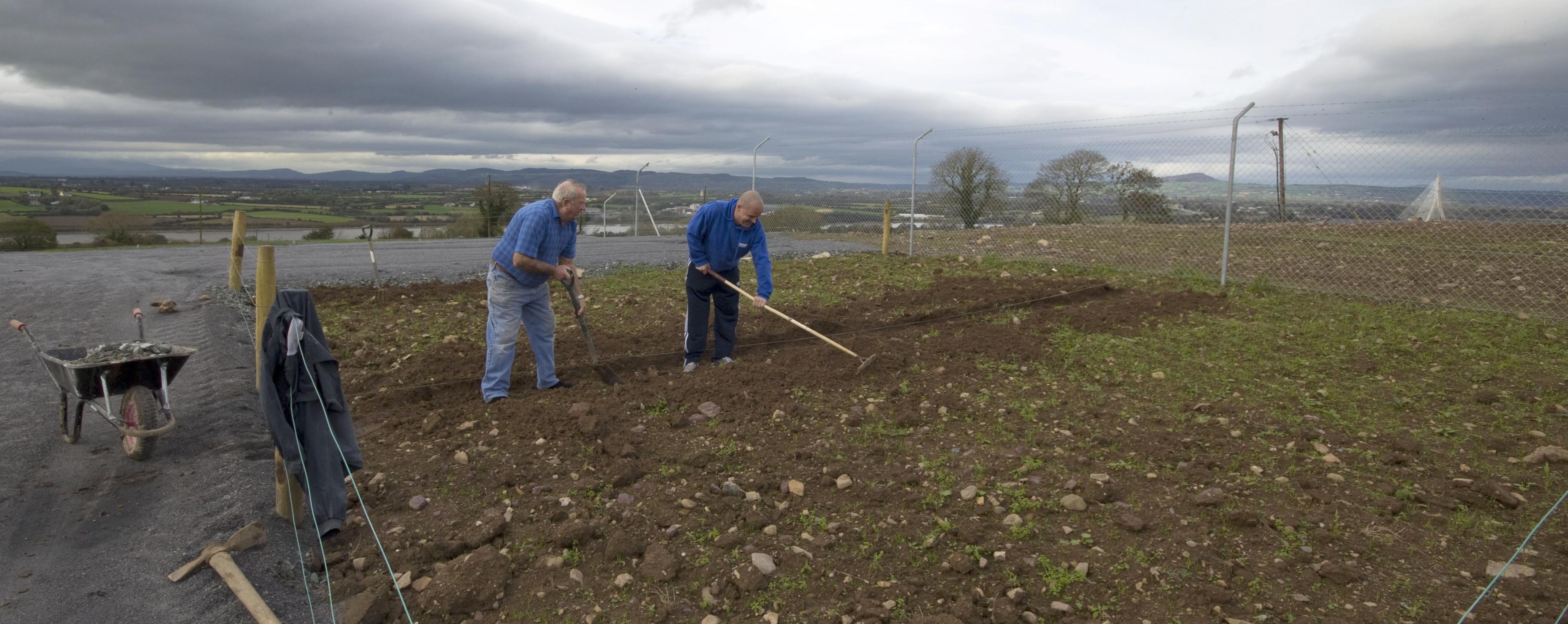
The replacement of natural boundary hedges and trees with walls and fencing leads to uncharacteristic urban features in rural areas and removes valuable hedgerows on which wildlife depends. Over the next plan period, the Council will discourage such development and encourage the planting of native and naturalised trees and hedgerows at the roadside boundaries of new housing developments, particularly in rural areas.
Policy Objective BD20 (Volume 1: Section 9.12) of the Development Plan requires the protection of hedgerows in all new developments, particularly species rich roadside and townland boundary hedgerows through incorporation into site landscaping schemes at project design stage. There will be a presumption against the removal of hedgerows where there is a reasonable alternative, and where these are being retained, they should be incorporated into public open space areas. Where their removal is unavoidable, replacement planting shall involve the establishment of new hedgerows with native species of local provenance that support pollinating species. Planting schemes shall be informed by the All-Ireland Pollinator Plan 2021-2025 and supporting guidelines, such as Pollinator Friendly Planting Code, and Hedgerows for Pollinators available on Pollinators.ie.
The following indigenous species may be recommended for planting anywhere in the county. Plants of local provenance are always preferable, and do not interfere with the genetics of other wild ‘populations’.
|
Yew |
Taxus baccata |
|
Aspen |
Populus tremula |
|
Silver birch |
Betula pendula |
|
Downy birch |
Betula pubescens |
|
Alder |
Alnus glutinosa |
|
Hazel |
Corylus avellana |
|
Sessile oak |
Quercus petraea |
|
Pedunculate Oak |
Quercus robur |
|
Crab apple |
Malus sylvestris |
|
Mountain ash |
Sorbus aucuparia |
|
Irish whitebeam |
Sorbus hibernica |
|
Hawthorn |
Crataegus monogyna |
|
Wild cherry |
Prunus avium |
|
Ash |
Fraxinus excelsior |
Irish native shrubs suitable for planting in Co. Waterford:
|
Rusty willow |
Salix cinerea oleifolia |
|
Eared willow |
Salix aurita |
|
Goat willow |
Salix caprea |
|
Blackthorn |
Prunus spinosa |
|
Broom |
Cytisus scoparius |
|
Furze / Gorse |
Ulex europaeus |
|
Dwarf gorse |
Ulex gallii |
|
Holly |
Ilex aquifolium |
|
Spindle |
Euonymus europaeus |
|
Elder |
Sambucus nigra |
|
Guelder rose |
Viburnum opulus |
|
Privet |
Ligustrum vulgare |
Irish native dwarf shrubs suitable for planting in Co. Waterford:
|
Cross-leaved heath |
Erica tetralix |
|
Bell heather |
Erica cinerea |
|
Ling |
Calluna vulgaris |
|
Bilberry Fraughan |
Vaccinium myrtillus |
The following indigenous trees, shrubs and climber can be recommended for use in exposed coastal areas.
|
Hawthorn |
Crataegus monogyna |
|
Blackthorn |
Prunus spinosa |
|
Ash |
Fraxinus excelsior |
|
Oak |
Quercus petraea |
|
Aspen |
Populus tremula |
|
Willows |
Salix cinerea oleifolia |
|
Irish Whitebeam |
Sorbus hibernica |
|
Holly |
Ilexaquifolium |
|
Elder |
Sambucus nigra |
|
Mountain Ash |
Sorbus aucuparia |
|
Common Alder |
Alnus glutinosa |
|
Burnet Rose |
Rosa pimpinellifolia |
|
Ivy |
Hedera helix |
The following exotic species can be recommended for use in exposed coastal areas as they are not known to spread by seed into habitats, though traditionally used in the countryside for decades.
|
Scots Pine |
Pinus sylvestris |
|
Corsican Pine |
Pinus nigra maritima |
|
Monterey Pine |
Pinus |
|
Oleaster |
Eleagnus spp. |
|
Escallonia |
Escallonia spp. |
|
Evergreen Oak |
Quercus ilex |
|
Laurustinus |
Viburnum tinus |
|
New Zealand Holly |
Olearia macrodonta |
It is usually best to maintain and manage existing specimens or populations of wild native plants in site boundaries where possible.
Some control of invasive non-native species may be needed. Himalayan Balsam, Winter Heliotrope, Japanese Knotweed, Giant Hogweed and some others can overwhelm a site, leading to poor biodiversity. Guidance on identification and control of these species is available on the invasive species section of the Biodiversity Ireland Website- biodiversityireland.ie.
Exotic species also have their place but are not recommended for dominant roles outside of parks and gardens. Rural gardens often blend in best with their surroundings when native species form a large component of the stock.
9.3 Naturalised (non-native) species
Leylandii (x cupressocyparis leylandii), Lawson Cypresses and Grisellinia look intrusive in the rural landscape and provide a poor habitat for wildlife. For this reason, they are normally unsuitable as hedging and screening plants in rural locations.
The Council will require that all inter-site hedging and screening plants should be restricted to a maximum height of 2.4 metres. The planting of shelterbelts, in coastal and upland areas is advisable.
In very exposed coastal areas, Holly and Escallonia may be the most suitable species. Sea Buckthorn and Rhododendron ponticum seed themselves profusely and are extremely damaging when they spread into coastal habitats. For this reason, these plants are not recommended for use. Hawthorn and Blackthorn may however be used in coastal areas.
9.4 Wastewater Treatment Infrastructure
A significant number of settlements in County Waterford have wastewater treatment systems that require upgrading before they can cater for any additional loading. There are some settlements that do not have any existing wastewater treatment systems. A database of the wastewater treatment facilities and capacities in each of the settlements is set out in Volume 1: Chapter 6 – Table 6.1. Whilst it is the Council’s preference that all new development connect to existing public treatment facilities without the need for upgrades being required, it is nonetheless also acknowledged that this may not be possible, and that the further expansion of some settlements may be dependent on new facilities being provided, and/ or infrastructural upgrades over the life time of the Plan.
Prospective developers are advised of the need to engage in discussions with the Council’s water services department and especially Irish Water, in order to ascertain the acceptability or otherwise of any given wastewater proposal to service any proposed multi-unit development.
Where developers are proposing the provision of a new permanent wastewater treatment facility (WWTF), or the replacement of existing insufficient WWTF, the following considerations shall apply:
|
Development Management DM 49 |
|---|
|
As a matter of guidance, where development is proposed which entails additional provision and/ or intervention/ upgrading is likely to be required, in order of priority:
- Option 1 - Upgrade of Existing Facility
The developer will pay 100% of the cost of the upgrade of the existing municipal wastewater treatment facility and/or network where this is possible for use by the development. This option would provide for the opportunity for a developer to finance the upgrade of the facility. However, the developer is required to frontload and carry the full 100% cost initially, and will be reimbursed through development contributions, as and when subsequent development occurs.
- Option 2 - Temporary Treatment Facility
This option will be appropriate only where Option 1 is considered impractical by the Council and where the size of the development will not cause any detrimental effect on the operation of the municipal waste water treatment plant or the quality of the receiving waters. A temporary treatment facility may be considered for the development where the effluent was treated on site to an agreed standard and then disposed of through the public sewer network.
A temporary treatment facility will only be considered where the contracts for the upgrading of the public wastewater treatment facility and/or network have been awarded or are at an advanced stage of planning. The temporary waste water treatment plant would be decommissioned by the developer and removed from site once the new upgraded municipal facility was provided. The developer must also provide for an eventual connection to the municipal facility. The developer shall pay the full standard development contribution and connection charges. The developer shall maintain the treatment facility until decommissioning takes pace and may be subject to a licence or a legal agreement.
- Option 3 - Alternative developer provided infrastructure (see also policy UTL 06 - Volume 1: Section 6.9)
Where a connection to public treatment/drainage infrastructure (certified or otherwise) is demonstrated to be unfeasible, and/ or is not available, alternative developer-provided infrastructure, such as integrated constructed wetlands, in collaboration with the Local Authority or otherwise, may be required/ facilitated, if it is satisfactorily demonstrated that disposal of foul water can be achieved without negative impacts on public health, amenity or the environment.
In all cases, it is recommended that prospective developers would enter into pre-planning discussions with the Planning Section and would liaise with the Water Services Section to ensure that proposals for wastewater treatment are acceptable. The detailed design of any such alternative developer provided infrastructure to service new development within settlements should meet the technical requirements of Irish Water.
Note: As per Section 5.3 of the Draft Water Services Guidelines for Planning Authorities, ‘Alternative solutions such as private wells or wastewater treatment plants should not generally be considered by planning authorities. Irish Water will not retrospectively take over responsibility for developer provided treatment facilities or associated networks, unless agreed in advance.’ The opportunity may arise for the development to connect into the network in the future however, the developer provided treatment facility may not be taken over.
- Rural Countryside/ Un-serviced Areas
Where the development of a single house is proposed outside of a designated settlement the Planning Authority will require that the applicant provides an on-site waste water treatment system in accordance with the EPA Codes of Practice (Wastewater Treatment Systems for Single Houses)[2] in force at the time of making the application.
Applications for planning permission for every individual dwelling in un-serviced areas must conduct a site suitability assessment using the methodology set out in the EPA Code of Practice and the site assessment must fully comply with the required standards, as overseen by an appropriately trained, qualified and accountable assessor and designer.
9.5 Mobility Management Plans (MMPS)
A Mobility Management Plan is an effective instrument used within the planning process to promote and support sustainable travel patterns at a site-specific level. It consists of a package of actions and measures to promote more sustainable and cost-effective travel habits among employees, clients and visitors. MMPs are applicable to all workplaces, colleges and hospitals as measures can be applied to staff, students and visitors.
MMPs can help to provide the impetus for modal change. They involve limited capital expenditure and concentrate on improving on-site facilities and more sustainable travel.
|
Development Management DM 50 |
|---|
|
As a guideline threshold, a Mobility Management Plan will be required if an existing or proposed development has the potential to employ over 100 persons, or in the case of residential development includes 100 dwellings or if it would generate significant travel demands. This is generally in line with the thresholds indicated in government policy documents. Appropriate developments requiring such a plan may include the following:
The National Transport Authority (NTA) document ‘Achieving Effective Workplace Travel Plans Guidance for Local Authorities’ (2012), should also be utilised as it contains valuable information on the recommended contents, targets and indicators of a Travel Plan. A mobility management plan may also be required by the Planning Authority for developments which employ less than 100 persons, particularly in the context of Waterford City where public transport is more widely available, and active modes of travel can be more widely utilised. |
9.6 Climate Action
Climate change is a global challenge which requires a strong and coherent response at national, regional and local level. Such aspects shall be addressed in the submission of a Climate Resilience report together with any proposed development and associated planning application.
|
Development Management DM 51 |
|---|
|
Assess applications for development, having consideration to any national guidelines and criteria set out below in respect of sustainable building practices and renewable energy that serve to reduce energy demand, reduce greenhouse gas emissions and address the necessity of adaptation to climate change in accordance with national and regional policy. All new development proposals will be required to include measures that incorporate sustainable building practices in accordance with the following criteria:
|
|
An Energy Statement should be included for all applications of 1000+ sqm. of commercial development, or applications of 15+ residential units, to demonstrate what energy efficiency and carbon reduction design measures are being considered. |
9.7 Pollution Control Development Management Requirements
Excessive noise and dust levels can have an adverse impact on the County’s environment. The Council will seek to minimise noise through the planning process by ensuring that the design of future developments incorporate measures to prevent or mitigate the transmission of noise and vibration, where appropriate.
While adequate lighting is essential to a safe and secure environment, light spillage from excessive or poorly designed lighting is increasingly recognised as a potential nuisance to surrounding properties and a threat to wildlife (incl bats) and habitats, may pose a traffic hazard and can reduce the visibility of the night sky. Urban and rural locations can suffer equally from this problem. Lighting columns and other fixtures can have a significant effect on the appearance of buildings and the environment.
|
Development Management DM 52 |
|---|
|
9.8 Flooding
Flood risk management will be carried out in accordance with the Flood Risk Management Guidelines for Planning Authorities, DOECLG (2009) and Circular PL2/2014.
Site Specific Flood Risk Assessments are required for all new planning applications in areas identified in areas at risk of flooding. The level of detail required for such a flood risk assessment will depend on the level of risk at the overall scale of development proposed. A detailed Site Specific Flood Risk Assessment should quantify the risks and the effects of proposed mitigation measures and detail any measures required to manage the residual risks.
9.8.1 Flood Risk Mitigation of Developments
Any development in the areas at risk of flooding that are required to have passed a ‘Justification Test’ must demonstrate that appropriate mitigation measures can be put in place and that residual risks can be managed to acceptable levels. The Flood Risk Management Guidelines for Planning Authorities identify the core principles in planning and designing for flood risk as:
|
Development Management DM 53 |
|---|
|
Site layouts, landscape planning and drainage of any new development must be closely integrated to play an effective role in flood reduction. The key elements include:
|
Development Management DM 54 |
|---|
|
For further detail on the above refer to Appendix B of the Planning Guidelines – The Planning System and Flood Risk Management Guidelines for Planning Authorities – Technical Appendices, November 2009.
9.8.2 Surface Water and Sewer Drainage/ Flooding
Surface water flooding occurs when the ground and rivers cannot absorb heavy rainfall and when man-made drainage systems have insufficient capacity to deal with the volume of rainfall. Typically, this type of flooding is localised and happens very quickly, making it very difficult to predict and give warnings. With climate change predicting more frequent short-duration, high intensity rainfall and more frequent periods of long-duration rainfall, coupled with sewer systems already at capacity, and increasing pressure from growing populations, surface water flooding is likely to be an increasing problem.
Therefore, to reduce the risk of surface water and sewer flooding, all development proposals are required to follow the following drainage hierarchy:
|
Development Management DM 55 |
|---|
|
Reducing the rate of discharge from development sites to greenfield runoff rates is one of the most effective ways of reducing and managing flood risk.
Greenfield run-off is the surface water drainage regime from a site prior to development. Thus, to maintain the natural equilibrium of a site, the surface water discharge from a developed site should not exceed the natural greenfield run-off rate. Advice on allowable discharge rates to watercourses for sites, or on the design criteria, technical feasibility and future sustainability of a drainage system can be found on the CIRIA website.
Wherever possible, Sustainable Drainage Systems (SuDS) techniques must be utilised. The surface water drainage techniques for a site, including SuDS, have to be decided at an early enough stage of the development so that sufficient space can be allocated. Sustainable drainage is integral to a development scheme and not an ‘add-on’.
Applicants and developers will need to submit evidence, as part of Flood Risk Assessments and/or part of an application Design Statement, that the above drainage hierarchy has been followed and SuDS have been utilized.
9.9 Archaeological Sites
In considering developments that have the potential to impact on archaeology (including marine archaeology), Waterford City & County Council promotes the need for pre-planning consultation with the Planning Authority and the National Monuments Service.
|
Development Management DM 56 |
|---|
|
In general, all applications for proposed development which are likely to impact on archaeological heritage/ sites must adhere to the guidelines on development issued by the National Monuments Service, the policies outlined in ‘Framework and Principles for the Protection of the Archaeological Heritage’ (the then Dept. of Arts, Heritage, Gaeltacht and Islands, 1999), and Archaeology in the Planning Process, 2021 (Leaflet 13) from the OPR and Department of Housing, Local Government and Heritage.
9.10 Institutional and Industrial Heritage
In relation to Institutional and Industrial Heritage, all development proposals for institutional and industrial buildings and sites of institutional and industrial archaeological importance, must be accompanied by an archaeological assessment of the building(s) and their surrounding environment. Retention and/or incorporation of such buildings will be encouraged. There will be a presumption against demolition. Where in exceptional circumstances demolition is permitted, it will have to be proven that loss of the architectural, historical, or other categories of interest, or a greater public interest will be served, which prevails over the loss to the existing architectural heritage, and a detailed building report will be required.
9.11 Tree Preservation Orders
In recognising the visual and ecological value of trees in some locations in the City and County, the Council will continue to make tree preservation orders where appropriate to do so.
Tree Preservation Orders are in place for the following 19 no. locations across the City (3 no.) and County (16 no.):
| Table 9. 1 Tree Preservation Orders | ||
|
Number |
File No |
Location |
|
1. |
15/71 |
Dooneen and Powersknock |
|
2. |
77/72 |
Woodhouse, Sheskin- Knockadrumlea |
|
3. |
347/72 |
Curraghmore Estate, Guilcagh Portlaw |
|
4. |
439/72 |
Deerpark, Ballymacarbry |
|
5. |
440/72 |
Ballymabin (Group) |
|
6. |
545/72 |
Ballyglan & Knockaveelish |
|
7. |
408/76 |
Ladies Cove, Dunmore East |
|
8. |
76/80 |
South East Fishermans Co-op, Passage East |
|
9. |
235/81 |
Kilmaloo West |
|
10. |
236/81 |
Rincrew |
|
11. |
473/82 |
Ballygally West and Glenbeg |
|
12. |
710/82 |
Kilbree East |
|
13. |
455/83 |
Ballyglan |
|
14. |
468/83 |
Coolgower |
|
15. |
599/83 |
Dromina |
|
16. |
14/85 |
Kilmanahan |
|
17. |
01/08 |
Christendom |
|
18. |
271/76 |
Glenville |
|
19. |
01/85 |
Ballindud |
|
20. |
To be progressed under Section 205 of the Planning and Development Act, 2000 (As Amended) during the lifetime of the Plan |
Corbally, Tramore |
|
21. |
To be progressed under Section 205 of the Planning and Development Act, 2000 (As Amended) during the lifetime of the Plan |
Pickardstown, Tramore |
|
22. |
To be progressed under Section 205 of the Planning and Development Act, 2000 (As Amended) during the lifetime of the Plan |
Cove, Tramore |
In addition to the above, the following are identified as a number of trees/tree groups which are considered to be of Special Amenity Value and worthy of protection within the Waterford City area:
| Table 9. 2 Waterford City: Trees of Special Amenity Value | ||
|
ID |
Location |
|
|
1. |
Trees in the grounds of Butlerstown House |
|
|
2. |
Trees at Gracedieu West |
|
|
3. |
Trees North of Gracedieu House |
|
|
4. |
Trees at Gracedieu East, south of the railway line |
|
|
5. |
Trees in the grounds of the Mercy Convent |
|
|
6. |
Trees in the grounds of Tycor House |
|
|
7. |
Trees at Bilberry Rock |
|
|
8. |
Trees in the townland of Ballybeg west of the Green Road |
|
|
9. |
Trees in the grounds of the former Waterford Crystal Factory, Cork Road |
|
|
10. |
Trees in the grounds of the Presentation Convent, Slievekeale Rd |
|
|
11. |
Trees in the grounds of the Good Sheppard campus of S.E.T.U. |
|
|
12. |
Trees in the grounds of Kingsmeadow House |
|
|
13. |
Trees in the grounds of Abbey Church, Ferrybank |
|
|
14. |
Trees in the grounds of Rocklands, Ferrybank |
|
|
15. |
Trees in the grounds of Sion Hill House, Ferrybank |
|
|
16. |
Trees in the grounds of Mount Misery, Ferrybank |
|
|
17. |
Trees at Bishopsgrove, Ferrybank |
|
|
18. |
Trees at Rockenham House, Ferrybank |
|
|
19. |
Trees in the grounds of the Courthouse |
|
|
20. |
Trees in the grounds of the Peoples Park |
|
|
21. |
Trees at Rockville, Newtown |
|
|
22. |
Trees in the grounds of Newtown School |
|
|
23. |
Trees at Fairyhill, Newtown |
|
|
24. |
Trees at Annaville, Newtown |
|
|
25. |
Trees at Chatsfort, Newtown |
|
|
26. |
Trees at Holmacre, Newtown |
|
|
27. |
Trees at Weston, Newtown |
|
|
28. |
Trees at Cove Lodge, Newtown |
|
|
29. |
Trees at Ballycar, Newtown |
|
|
30. |
Trees in the grounds of the former Glanbia Plant in Glenville |
|
|
31. |
Trees on the River Suir bank at Glenville |
|
|
32. |
Trees in the grounds of Maypark Nursing Home |
|
|
33. |
Trees in the grounds of University Hospital Waterford |
|
|
34. |
Trees at Cherry Mount St. John;s Hill |
|
|
35. |
Trees in the grounds of St. Johns College |
|
|
36. |
Trees in the grounds of the Ursuline Convent, Ballytruckle |
|
|
37. |
Trees in the grounds of St. Otterans Hospital |
|
|
38. |
Trees in Riverwoods Estate |
|
|
39. |
Trees in the grounds of Oaklands, Ballinakill |
|
|
40. |
Trees at Granstown House, Earlscourt |
|
|
41. |
Trees in Kings Channel Estate |
|
|
42. |
Trees at Oak Villa, Military Road |
|
|
43. |
Trees at St. Thomas's Church |
|
|
44. |
Trees at Ballinakill Downs and the adjoining lands to the north |
|
|
45. |
Trees north of the Dunmore Road, adjacent to Riverside Cottage Restaurant |
|
|
46. |
Trees to the north of Knockboy Cottage |
|
| 47. |
Trees on the River Suir bank east of Kings Channel |
|
| 48. |
Trees on the River Suir bank north of Blenheim |
|
| 49. |
Trees in the vicinity of Blenheim Lodge |
|
| 50. |
Trees adjacent to Halfway House Bridge |
|
| 51. |
Trees on Little Island |
|
| 52. |
Trees in Leoville Estate, Dunmore Road |
|
| 53. |
Trees in Prospect Mews, Ballytruckle |
|
| 54. |
Trees in the grounds of Grace Dieu House, Ballindud |
|
| 55. |
Trees in the grounds of Ballindud House |
|
| 56. |
Trees at Ballinakill House |
|
| 57. |
Trees at Ballycanvan |
|
| 58. |
Trees at Wooodland Pill |
|
| 59. |
Trees at Knockboy beside Dunmore Ave |
|
|
60. |
Trees at Killure Grove | |
|
61. |
Trees at Mount Druid | |
|
62. |
Trees at Faithlegg | |
|
63. |
Trees at Brook Lodge | |
|
64. |
Trees in the grounds of De La Salle School | |
9.12 Allotments
Allotments are an important component of open space, and offer a diverse range of benefits for people, communities and environments. They provide recreational value, support biodiversity and landscape quality, contribute to physical and mental wellbeing, provide the possibility to grow fresh produce and contribute towards a healthy lifestyle that is active, sustainable and socially inclusive.
|
Development Management DM 57 |
|---|
|
Where appropriate, the provision of allotments or other food growing space, alongside the provision of other private, semi-private and public open spaces, will be supported if opportunities arise as part of new developments. |
9.13 Living (Green) Roofs and walls
Living roofs and walls, in particular green roofs, are an essential sustainable design consideration and can take many forms in order to maximise their benefits in a given location. Living roofs should be designed and incorporated into an overall design proposal green infrastructure system/ network for proposed development - linking to other green infrastructure elements of adjacent sites/ surroundings. Vegetated roofs and walls have many benefits, including:
- As Sustainable Drainage Systems (SuDS) to avoid rapid rain run-off into drains and rivers and improve water quality;
- Adaptation to climate change and reduction in urban heat island effect (i.e. aiding cooling);
- Mitigation of climate change and carbon savings (i.e. aiding energy efficiency);
- Enhancement of biodiversity and important refuges for wildlife in urban areas;
- Provision of green space and potentially accessible roof space;
- Improvements to visual appearance;
- Enhanced roof and sound insulation properties and resilience of the building;
- Enhanced roof lifespan by protecting underlying waterproofing system;
- Reduction in air and noise pollution;
- Growing food.
A living roof is defined as having a minimum of 70% soil/ vegetation coverage, with a minimum substrate depth of 85mm, and a maximum of 30% hard-standing. Living roofs are not roof terraces. Living roofs can be installed on any pitch of roof; however, as the pitch increases, additional specific design measures will be required in order to retain the substrate across the roof surface, which will result in increased costs.
|
Development Management DM 58 |
|---|
|
9.14 Seveso Sites & COMAH Regulations 2015
Major industrial accidents involving dangerous substances pose a significant threat to humans and the environment; such accidents can give rise to serious injury to human health or serious damage to the environment, both on and off the site of the accident. In Europe, a catastrophic accident in the Italian town of Seveso in 1976 prompted the adoption of legislation on the prevention and control of such accidents (the Seveso Directives[6]).
The Chemicals Act (Control of Major Accident Hazards involving Dangerous Substances) Regulations 2015 (S.I. No. 209 of 2015) (the “COMAH Regulations”), implement the Seveso III Directive (2012/18/EU). The purpose of the COMAH Regulations is to lay down rules for the prevention of major accidents involving dangerous substances, and to seek to limit as far as possible the consequences for human health and the environment of such accidents, with the overall objective of providing a high level of protection in a consistent and effective manner.
The COMAH Regulations apply to any establishment that presents a major accident hazard because of the presence of dangerous substances in quantities that exceed specified thresholds. The Central Competent Authority (CCA) in Ireland, being the Health & Safety Authority (HSA), will advise the relevant Planning Authority of a consultation distance for an establishment, following the receipt of a notification from the operator.
The HSA shall provide technical advice in response to a notice sent by a Planning Authority under Part 11 of the Planning & Development Regulations 2001 (as amended) requesting technical advice on the effects of a proposed development on the risk or consequences of a major accident in relation to such sites. The final planning decision rests with the Planning Authority.
There is one Seveso Site in County Waterford. The site is located at Waterford Airport. The site is operated by Stafford Wholesale and has a 600m consultation zone around the Seveso Site. There is also one Upper Tier establishment located in Christendom, Ferrybank, Co. Kilkenny, on the north bank suburb of the River Suir in Waterford City. The site is operated by Trans Stock Cold Storage and Warehousing Ltd. A 700 metre consultation zone is currently operational around this Seveso site, where planning applications received for development should be referred to the HSA for technical advice to the Planning Authority.
9.15 ‘Living-Over-The-Shop’
In encouraging the residential use of the upper floors of commercial properties in established retail/commercial areas the Council will consider possible dispensations from normal standards to facilitate ‘Living-Over-The-Shop’ developments, that will contribute positively to the renewal of areas provided any proposed modifications will not have a negative impact on visual amenities or the existing streetscape. The Planning Authority will encourage ‘living over the shop’, subject to suitability of location, standard of accommodation proposed, and the following should be noted in this regard:
Derogations for older commercial buildings in appropriate cases may be given in respect of private open space, parking, and unit size standards.
Derogations for car parking may be allowed having regard to parking policy.

[1] As defined in Appendix 4 of the ‘Sustainable Rural Housing Guidelines for Planning Authorities DoEHLG 2005’
[2] Current Edition (2021): https://www.epa.ie/publications/compliance--enforcement/waste-water/2021_CodeofPractice_Web.pdf