Section 6.0 Rural Development
6.1 Rural Development
In visually sensitive areas, the Planning Authority will require that:
|
Development Management DM 32 |
|---|
|
6.2 Micro Enterprises/Rural Diversification
Waterford City & County Council will consider rural micro-enterprises in areas outside of designated settlements where the following criteria are adhered to:
|
Development Management DM 33 |
|---|
|

6.3 Home-Based Economic Activity
The Council also recognises the role for appropriately scaled home-based economic activity. Such activity is defined as small scale commercial activity carried out by residents of a house, being subordinate to the use of the house as a single dwelling unit and includes working from home. The home-based activity should be ancillary to the main residential use and the resident continues to reside in the house. The proposal shall not have any adverse impacts on the amenities of neighbouring dwellings. In determining applications involving working from home the planning authority will have regard to the following:
|
Development Management DM 34 |
|---|
|
6.4 Mineral Extraction
The Council recognises that the extractive industry plays an important role in the construction industry and with appropriate care in initial site selection, process design and environmental monitoring, mineral extraction can be compatible with a wide range of appropriate adjacent land uses and habitats. Section 261 of the Planning & Development Act 2000 (as amended), provided for the registration and control of quarries. All new applications for quarries shall be assessed and have regard to DoEHLG Guidelines such as the “Quarries and Ancillary Activities”, 2004, Guidelines for Environmental Management in the Extractive Sector (EPA, 2006), “Guidance on Biodiversity in the Extractive Industry” (NPWS), GSI’s Geological Heritage “Guidelines for the Extractive Industry”, the Archaeological Code of Practice and the Irish Concrete Federation Environmental Code (2005), and any other relevant superseding policy guidance.
Environmental Impact Assessment (E.I.A.) and the submission of an Environmental Impact Assessment Report (EIAR) will be required with a planning application where the defined thresholds outlined in the Planning & Development Regulations 2001 (as amended) are exceeded for certain types of development. In cases where thresholds are not exceeded the Planning Authority may still exercise its powers under Article 103(1) of the Regulations 2001 (as amended), and require the applicant to submit to the Authority the information specified in Schedule 7A for the purposes of a screening determination where there is significant and realistic doubt in regard to the likelihood of significant effects on the environment arising from the proposed development, or where it is determined that there is a real likelihood of significant effects on the environment arising from the proposed development, to submit to the Authority an EIAR in order for the Planning Authority to fully assess the impacts of proposed development on the surrounding area.
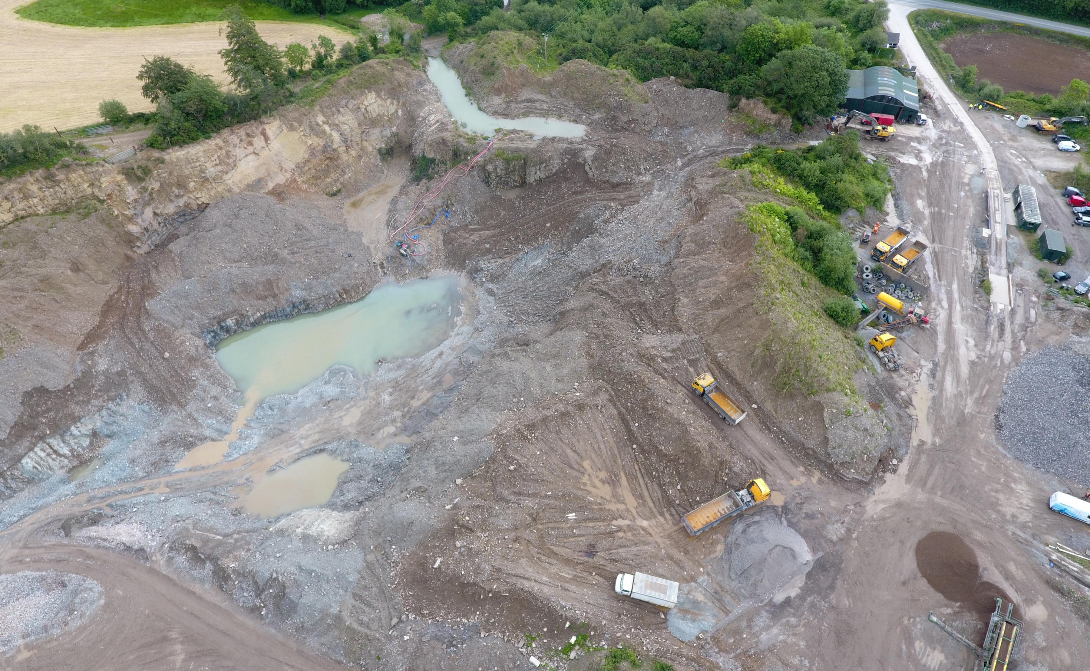
Planning applications which relate to the extractive industry (including cement batching facilities, quarries and sand and gravel pits), shall be assessed having regard to:
|
Development Management DM 35 |
|---|
|
Details which should be submitted by the applicant as part of proposal:
|
|
Development Management DM 36 |
|---|
|
Where it is proposed to reclaim, regenerate or rehabilitate old quarries by filling or re-grading with inert soil or similar material, or to use worked-out quarries as disposal locations for inert materials, the acceptability of the proposal shall be evaluated against the following key criteria:
The Council will resist development that would significantly or unnecessarily alter the natural landscape and topography, including land infilling/reclamation projects or projects involving significant landscape remodeling, unless it can be demonstrated that the development would enhance the landscape and / or not give rise to adverse impacts. |
Permissions granted for planning applications which relate to extractive industries will also be subject, by way of planning condition, to the lodgement, by the developer, of a financial bond to ensure the satisfactory reinstatement of the site following the completion of extraction. This bond shall be index linked.
It should also be noted that a special contribution levy may be required from the developer towards the cost of upgrading or repairing the local roads serving the quarry, and to minimise the adverse impacts of associated quarry operations on the road network.
6.5 Forestry
Forests and woodlands are a natural resource which can provide commercial, recreational, environmental, amenity and aesthetic benefits to the County. Forestry can provide a supplementary form of farm activity through planting maintenance and harvesting and can also provide a sustainable construction material and a source of renewable energy.
The Council will ensure that all afforestation is carried out in compliance with Government policy (as updated and reviewed), as set out by the Department of Agriculture, Food and the Marine in “Forests, Products and People – Ireland’s Forest Policy – A Renewed Vision” (2014), . Initial afforestation is exempted under the Planning and Development Regulations 2001 (as amended)[1] while an Environmental Impact Assessment is only required for afforestation exceeding areas of 50ha. Forestry should not obstruct existing rights of way, traditional walking routes, and recreational facilities. The Council require that the following standards are adhered to:

|
Development Management DM 37 |
|---|
|
To protect the safety of operations at Waterford Regional Airport, forestry plantation proposals should have regard to Appendix 12 of the Development Plan 2022-2028 (Waterford Regional Airport & Business Park Masterplan), which contains details of Airport Control Zones. It is recommended that applicants should also consult with Waterford Airport plc and/or the Planning Authority prior to the advancement of forestry proposals.
[1] Subject to the general conditions and limitations pertaining to exempted development