Chapter 9: Climate Action, Biodiversity & Environment
| Strategic Objectives |
|---|
|
Integrate climate change and adaptation considerations into land-use policy objectives and decision-making processes to enhance our resilience to the effects of Climate Change and reducing our carbon footprint. |
| We will protect, manage, and enhance the natural heritage, biodiversity, landscape and environment of Waterford City and County in recognition of its importance as a non-renewable resource, providing a unique identity and character for the City and County as a natural resource asset. |
9.0 Introduction
A Climate Change and Biodiversity Loss Emergency was declared by the Government in May 2019 following publication of a report by the Intergovernmental Panel on Biodiversity and Ecosystem Service on the state of the world’s biodiversity and ecosystem services. This report starkly detailed an unprecedented and dangerous decline in nature, accelerating rates of species extinction, an insufficient global response and the need for transformative change to restore and protect nature.
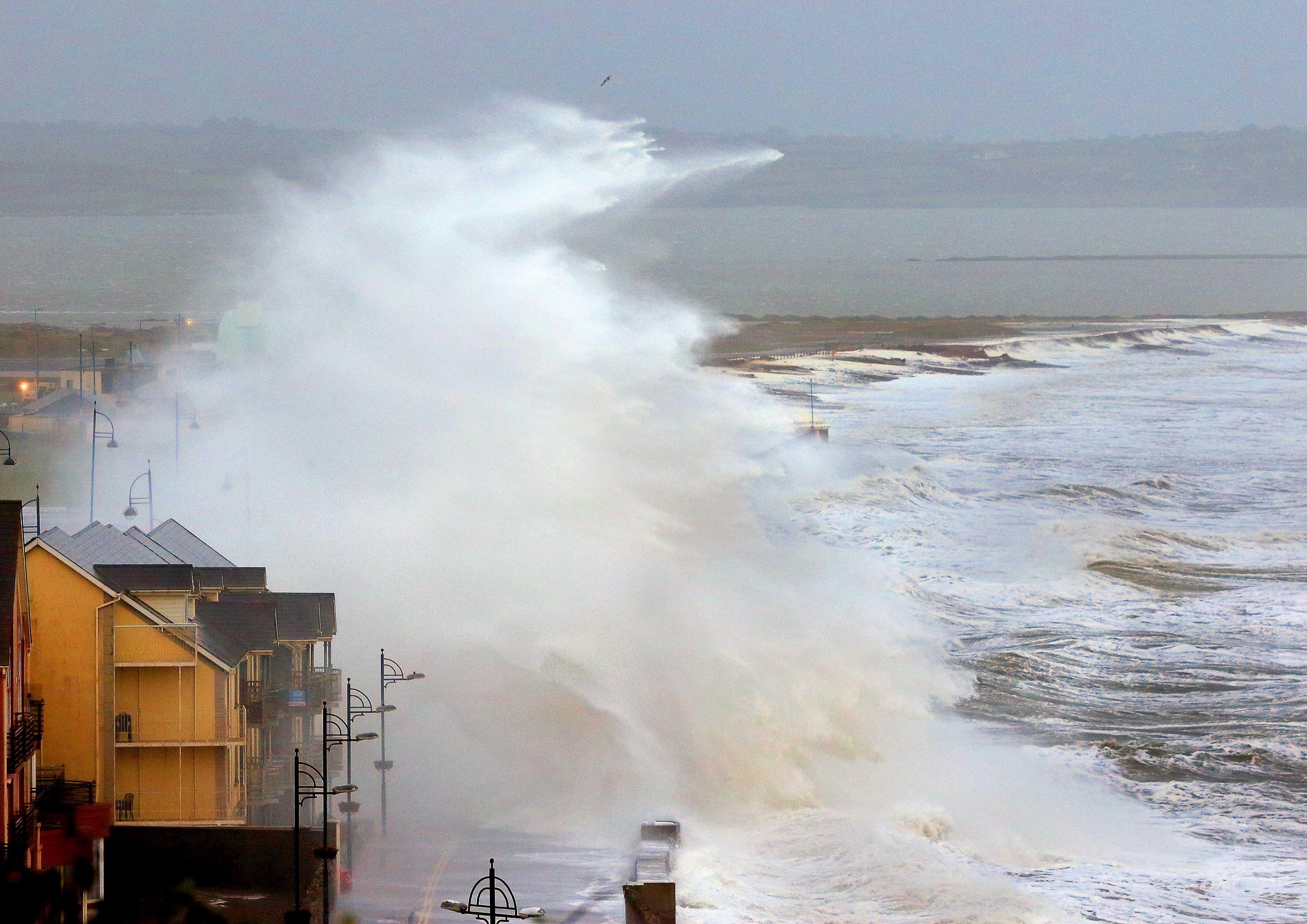
The State of the Environment Report (EPA 2020) presents trends and indicators of a declining environmental quality for Ireland. Ecological status for habitats and species and water quality are under threat from a range of development pressures and land management practices whilst climate change impacts are presenting increased intensity and frequency of storm events, increased periods of flooding and drought and rising sea level. A coastal county such as Waterford is at risk from climate change events; climate adaptation measures and nature-based solutions are required to be inherent to all future land use planning and development proposals.
|
Regulatory Framework and Decision-Making Policy Objectives |
|
|---|---|
|
ENV 01 |
Through implementation of the Development Plan we will ccumulatively contribute towards – in combination with other users and bodies – the achievement of the objectives of the regulatory framework for environmental protection and management, including compliance with EU Directives - including the Habitats Directive (92/43/EEC, as amended), the Water Framework Directive(2000/60/EC), the Birds Directive (2009/147/EC), the Environmental Impact Assessment Directive (2011/92/EU, as amended by 2014/52/EC) and the Strategic Environmental Assessment Directive (2001/42/EC) – and relevant transposing Regulations. |
|
ENV 02 |
Lower levels of decision making, and environmental assessment shall consider the sensitivities identified in the SEA Environmental Report that accompanies the Plan, including the following:
|
|
ENV 03 |
The Council shall, in conjunction with the Regional Assembly and other sources as relevant, implement the monitoring programme as set out in the SEA Environmental Report and Statement. This will include the preparation of stand-alone SEA Monitoring Reports on the significant environmental effects of implementing the Plan, in advance of the beginning of the review of the next Plan.
On the significant environmental effects of implementing the Plan, in advance of the beginning of the review of the next Plan. |
9.1 Climate Change
In 2021 the Government published the Climate Action and Low Carbon Development (Amendment) Act which commits a move to a climate resilient and climate neutral economy by 2050. The Program for Government commits to a 7% average yearly reduction in overall greenhouse gas emissions over the next decade, and to achieving net zero emissions by 2050. The Bill brings in a system of 5-year economy-wide carbon budgets, which will outline a ceiling for total greenhouse gas emissions. These will be prepared by the Climate Change Advisory Council and presented to Government to consider and approve, with input from the Oireachtas. The Bill includes the following key elements:
- Establishes a 2050 emissions target
- Introduces system of successive 5-year, economy-wide carbon budgets starting in 2021
- Strengthens the role of the Climate Change Advisory Council in proposing carbon budgets
- Introduces a requirement to annually revise the Climate Action Plan and prepare a National Long-Term Climate Action Strategy at least every decade
- Introduces a requirement for all Local Authorities to prepare individual Climate Action Plans which will include both mitigation and adaptation measures
Waterford City and County Council published its Climate Adaption Strategy in 2019 which seeks to implement best practices and incorporate solutions that will meet climate change adaptation requirements and service the needs of the communities. It should be noted that Climate Change is a cross cutting theme evident throughout all chapters of the Development Plan and as such reference should be made to the relevant policy objectives identified throughout this document.
|
Regulatory Framework and Climate Change Policy Objectives |
|
|---|---|
|
CA 01 |
To support and implement the policies of the Waterford Climate Adaptation Strategy in collaboration with Waterford Climate Action Team the Climate Action Regional Office (CARO), and review/replace the strategy pursuant to the provisions of the Climate Action Plan 2021 and Low Carbon Development Act. We will vary the Development Plan as necessary following the review/replacement of the strategy. |
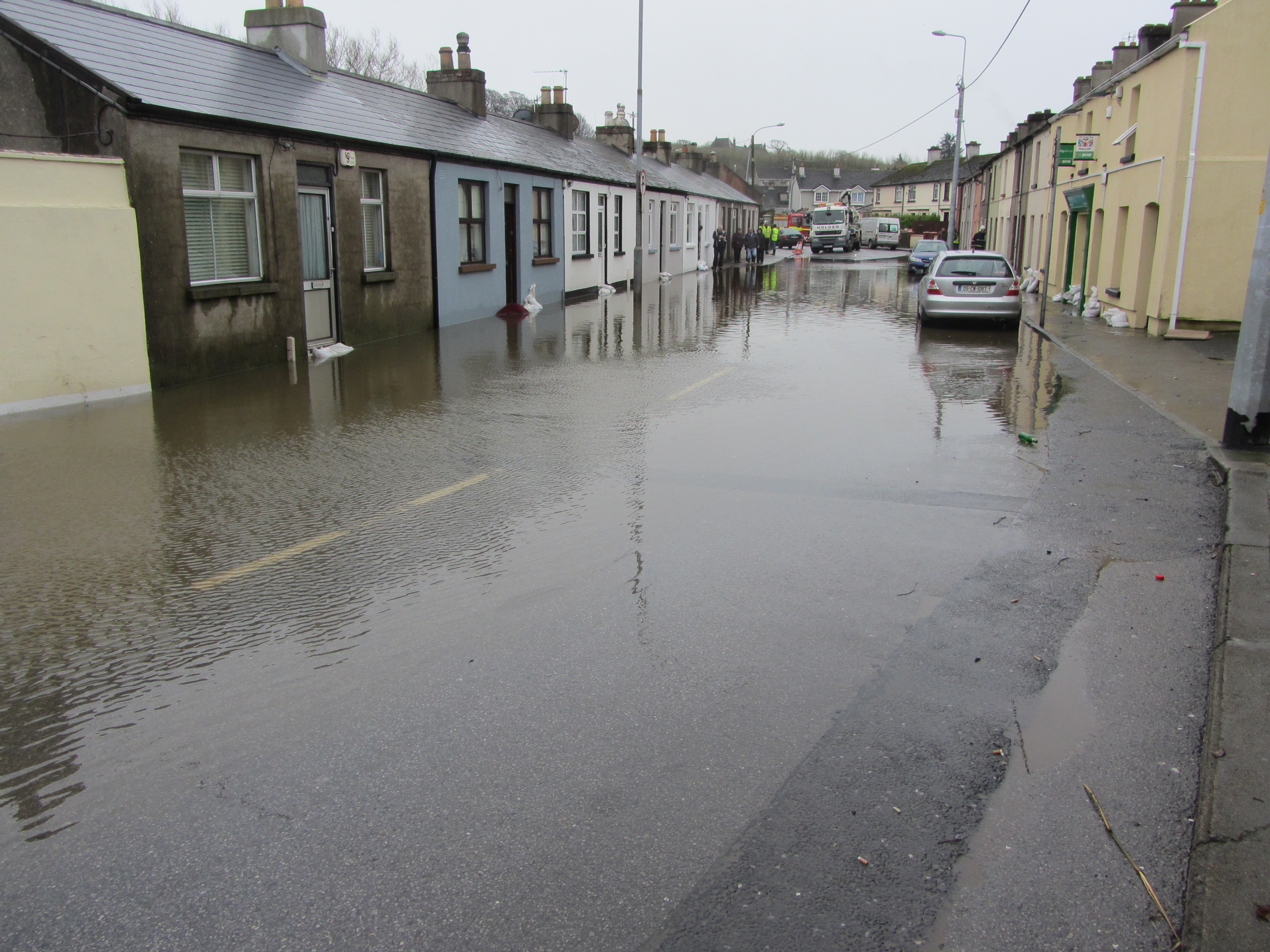
9.2 Flood Management
Flooding is a natural process that can happen at any time in a wide variety of locations and plays a role in shaping the natural environment. Flooding from the sea and from rivers is probably best known but prolonged and intense rainfall can also cause sewer flooding, overland flow and flooding from groundwater. Where it impacts on human activities, it can threaten people, their property and the environment. Of increasing concern are the consequences of climate change which are impacting on sea levels, the nature and pattern of rainfall events and general weather patterns. While the exact impacts of change are not known, it is widely agreed that climate change will result in higher risk of flooding of both inland and coastal locations. A number of policy objectives relating to how we improve our management of storm water and the impacts of flooding have been set out in Chapter 6. The following additional policies apply:
|
Flood Management Policy Objectives |
|
|---|---|
|
FM 01 |
Waterford City & Council will work with the OPW, LAWPRO and other agencies at a catchment-level to identify any measures, such as natural water retention measures, that can have benefits for, water quality, flood risk management and biodiversity objectives. |
|
FM 02 |
Waterford City & Council will protect floodplains of river catchments in the County and retain them for their flood protection and natural heritage values. |
9.3 Water Quality
Waterford City and County is heavily dependent on groundwater for its water supply. At present, groundwater is extracted as a source of public water supply for the majority of the city and county population. Due to the fact that over large areas of the County the depth to bedrock is less than 3 metres, the continued preservation of the quality of the groundwater in these areas is essential to sustaining communities. The Geological Survey of Ireland (GSI) compiled the Groundwater Protection Scheme for County Waterford which identified the main sources for groundwater within the County and the vulnerability of such resources to environmental pollution.
An effective on-site wastewater system requires regular maintenance and must be properly located in a setting that will not give rise to hydraulic issues or groundwater pollution. All proposals for development that entail the discharge of wastewater to ground will be discouraged and will be required to comply with the EPA Code of Practice for domestic wastewater treatment systems.
The Council will use statutory powers under relevant planning and environmental legislation to protect groundwater, including planning and environmental impact assessments, integrated pollution control and /or water pollution legislation in balancing the need for development with the need to protect the environment. The Ground Water (Amendment) Regulations (2016) provide for clear environmental objectives and groundwater quality standards to strengthen the regime for the protection of groundwater.
9.4 Compliance with the EU and national legislation and guidance on water quality.
Development proposals will be evaluated to assess their compliance with standards and legal requirements of the following where they apply.
- Water Framework Directive (2000) and the River Basin District Management Plan 2022-2027.
- EPA Code of Practice: Domestic Wastewater Treatment Systems (PE ≤ 10) (2021).
- Surface Water Regulations (2009)
- Ground Water (Amendment) Regulations (2016)
- Wastewater Discharge Regulations (2001 as amended)
- Urban Wastewater Treatment Regulations (2004)
- Bathing Water Regulations (2008)
- Quality of Shellfish Waters (2006)
- Guidelines for the incorporation of the Water Framework Directive into the Planning System 2022.
European and Irish legislation continue to place a strong emphasis on achieving a high standard of water quality. The Water Framework Directive, which was adopted in 2000, required that “good status” is achieved in all water bodies by 2027. The eutrophication of rivers, lakes and tidal waters is one of the main threats to surface waters with agricultural runoff and municipal discharges being the key contributors.
The Wastewater Discharge (Authorisation) Regulations 2007 came into effect in 2007 and has placed increased obligations on Water Services Authorities relating to the licensing of discharges from wastewater treatment plants, facilitating greater implementation of the Water Framework Directive and other relevant EU Directives. The licensing system which is regulated by the Environmental Protection Agency (EPA) and sets strict limits on discharges allowed from these plants into our surface waters such as rivers, canals, lakes, coastal waters, and groundwater. Under the Water Framework Directive a managment plan must be prepared for all River Basin Districts (RBDs). The third RBDMP plan was published in 2022 and outlines the current status of our waters, environmental objectives for our waters, and the programme of measures which may be necessary in order to achieve these objectives.
The EU Nitrates Directive (91/676/ECC) requires member states to take specific measures to protect surface water and groundwater from nitrate contamination from agricultural activities. A Farm Waste Management Scheme introduced in 2006 provided grants to farmers to meet their slurry storage requirements and it is now the responsibility of individual farmers to ensure that they are compliant with the Good Agricultural Practice Regulations.
The fourth review of the Nitrates Action Plan and Nitrates Regulations were signed into law in 2018 designed to prevent pollution of surface waters and ground waters from agricultural sources and to protect and improve water quality. The European Communities (Good Agricultural Practice for Protection of Waters) Regulations 2020 revise and replace the previous Regulations made in 2018. They provide for strengthened enforcement provisions and for better farmyard management.
A fifth review of the Nitrates Action Plan took place in 2022 and will inform the European Communities (Good Agricultural Practice for Protection of Waters) Regulations 2020 providing for strengthened enforcement provisions and for better farmyard management in order to prevent pollution of surface waters and ground waters from agricultural sources and to protect and improve water quality.
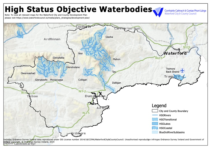
Figure 9.1 High Status Objective Waterbodies
9.5 Bathing Water Quality
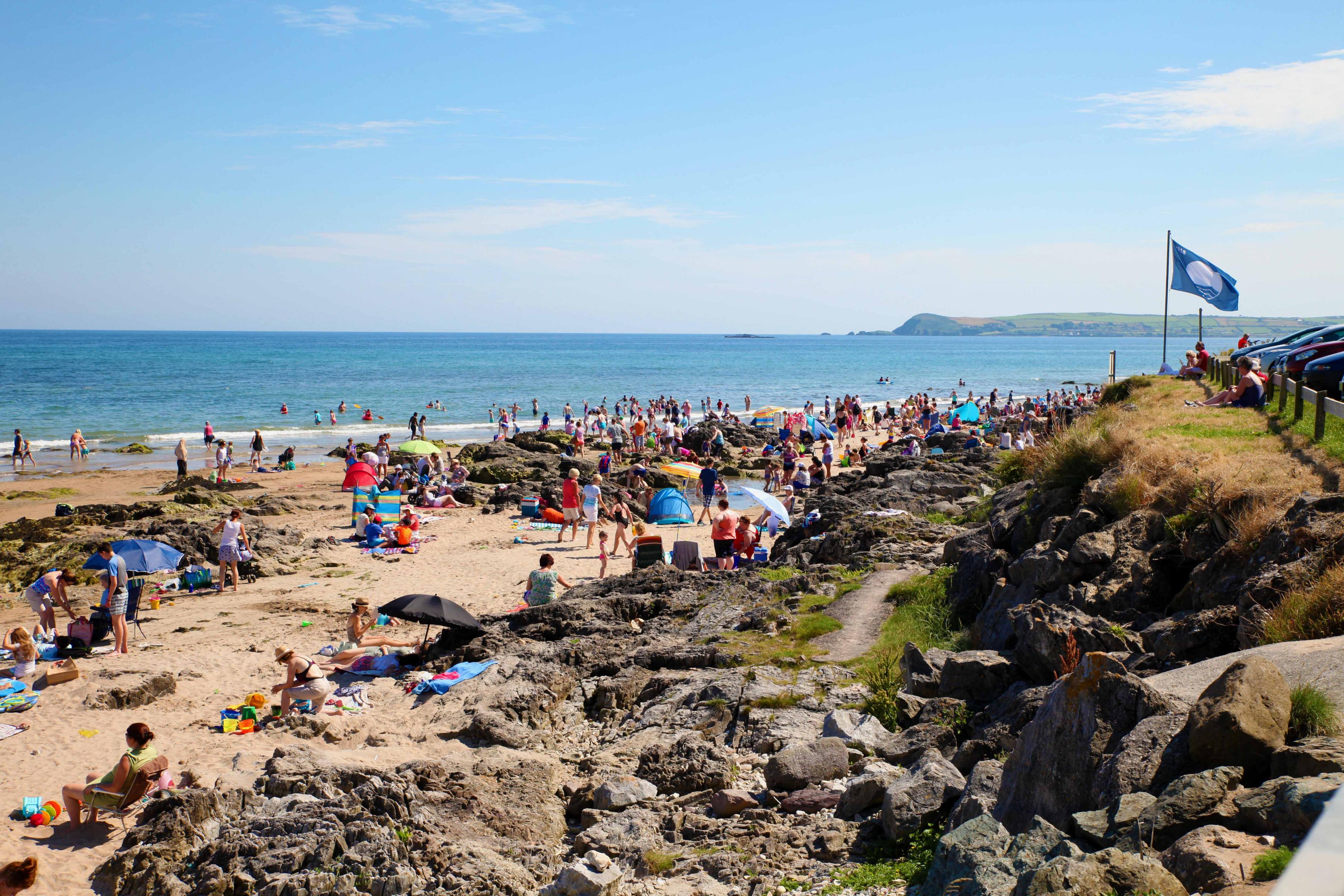
Bathing Water Quality Regulations were made in 2008 transposing the EU Bathing Water Directive of 2006 into Irish law. Beaches at Ardmore, Clonea, Tramore and the two strands in Dunmore East have maintained Blue Flag status.
|
Water Quality Policy Objectives |
|
|---|---|
|
WQ 01 |
Water Framework Directive and Associated Legislation We will contribute towards, as appropriate, the protection of existing and potential water resources, and their use by humans and wildlife, including rivers, streams, wetlands, the coastline, groundwater and associated habitats and species in accordance with the requirements and guidance in the EU Water Framework Directive 2000 (2000/60/EC), the European Union (Water Policy) Regulations 2003 (as amended), the European Communities Environmental Objectives (Surface Waters) Regulations 2009 (as amended), the Groundwater Directive 2006/118/EC and the European Communities Environmental Objectives (groundwater) Regulations 2010 (as amended) and other relevant EU Directives, including associated national legislation and policy guidance (including any superseding versions of same). To support the application and implementation of a catchment planning and management approach to development and conservation, including the implementation of Sustainable Drainage System techniques for new development. |
|
WQ 02 |
Achieving High/ Good Water Quality Status In order to maintain water quality at high status and a return to good status for rivers that are not meeting this threshold at present we will:
|
|
WQ 03 |
River Basin Management Plan Support the implementation of the relevant recommendations and measures as outlined in the River Basin Management Plan 2018-2021, and associated Program of Measures, or any such plan that may supersede same during the lifetime of the plan. Proposed plans, program and projects shall not have an unacceptable impact on the water environment, including surface waters, groundwater quality and quantity, river corridors and associated woodlands. Also, to have cognisance of, where relevant, the EU’s Common Implementation Strategy Guidance Document No. 20 and 36 which provide guidance on exemptions to the environmental objectives of the Water Framework Directive. |
|
WQ 04 |
Catchment-sensitive Farming Practices We will encourage the use of catchment-sensitive farming practices, in order to meet Water Framework Directive targets and comply with the River Basin Management Plan. |
|
WQ 05 |
Bathing Water Quality We will maintain Bathing Water standards in line with the EU Bathing Water Directive and increase the number of blue flag beaches. |
|
Environmental Quality Policy Objectives |
|
|---|---|
|
ENV 04 |
Air and Energy We will contribute towards compliance with air quality legislation; greenhouse gas emission targets; management of noise levels; and reductions in energy usage. |
|
ENV 05 |
CAFE Directive Promote the preservation of best ambient air quality compatible with sustainable development in accordance with the EU Ambient Air Quality and Cleaner Air for Europe (CAFE) Directive (2008/50/EC) and ensure that all air emissions associated with new developments are within Environmental Quality Standards as out in the Air Quality Standards Regulations 2011 (SI No. 180 of 2011) (or any revisions thereof). |
|
ENV 06 |
Human Health Assess proposals for development in terms of; inter alia, potential impact on existing adjacent developments, existing land uses and/or the surrounding landscape. Where proposed developments would be likely to have a significant adverse effect on the amenities of the area through pollution by noise, fumes, odours, dust, grit or vibration, or cause pollution of air, water and/or soil, mitigation measures shall be introduced in order to eliminate adverse environmental impacts or reduce them to an acceptable operating level. |
|
ENV 07 |
Radon Ensure the implementation of the specific guidance on radon prevention measures for new homes as contained within the existing Building Regulations (including any updated/superseding regulations that may be published within the lifetime of this Plan). |
|
ENV 08 |
Soil Protection, Contamination and Remediation Ensure that adequate soil protection measures are undertaken where appropriate. Adequate and appropriate investigations shall be carried out into the nature and extent of any soil and groundwater contamination and the risks associated with site development work, where brownfield development is proposed. The EPA’s publication Code of Practice: Environmental Risk Assessment for Unregulated Waste Disposal Sites (2007) shall be taken into account as relevant by proposals for development within or adjacent to old landfill sites. All undeveloped, contaminated sites shall be remediated to internationally accepted standards prior to redevelopment. All applications shall be accompanied by a report from a qualified, expert remediation consultant incorporating international best practice and expertise on innovative ecological restoration techniques including specialist planting and green initiatives that create aesthetically improved sites, healthy environments and contribute to the provision of new green open spaces as integral parts of newly created areas. Treatment/management of any contaminated material shall comply as appropriate with the Waste Management Act 1996 (waste licence, waste facility permit), as amended, and under the EPA Act 1992 (Industrial Emissions licensing, in particular the First Schedule, Class 11 Waste), as amended. These measures will ensure that contaminated material will be managed in a manner that removes any risk to human health and ensures that the end use will be compatible with any risk. Prior to the grant of approval on contaminated sites, developers will be required to carry out a full contaminated land risk assessment to demonstrate:
|
9.6 Biodiversity
Biodiversity, natural capital and the benefits we derive from nature now commonly referred to as Ecosystem Services are increasingly recognised as being integral to planning and land use policies, as these resources underpin the wellbeing of the economy, society and individuals. Woodlands and forests store carbon, wetlands and coastal zones provide buffers against flood while a host of species enable pollination and maintain soil structure and fertility. It is clear that these ecosystem services are under threat and thus maintenance and enhancement of our biodiversity is a key requirement for policy makers and the wider community. Waterford City & County Council are committed to identifying the City & County’s ecological infrastructure, maintaining the favourable conservation status of protected areas and restoring and enhancing degraded areas of biodiversity value.
A Heritage Plan (2017-2022) was published by the local authority in 2017 which includes objectives for conservation of biodiversity). The aims of the Heritage Plan are to address priority information gaps in the City and County, increase understanding and raise awareness of biodiversity and maintain and enhance biodiversity through management practices in key areas. In 2019 Waterford City & County Council signed a Framework Agreement with the National Biodiversity Data Centre supporting implementation of the All-Ireland Pollinator Plan. The Council are committed to improving work practices and implementing policies that deliver benefits for pollinator habitats and have included actions such as promotion of green procurement, set aside meadows with reduced and delayed mowing, removal of pesticides from all Council operated parks, pollinator friendly planting and winning the Green Flag for Parks Award in 2020 for Kilbarry Nature Park.

|
Biodiversity Policy Objectives |
|
|---|---|
|
BD 01 |
We will protect and conserve all sites designated or proposed for designation as sites of nature conservation value (Natura 2000 Network, Ramsar Sites, NHAs, pNHAs, Sites of Local Biodiversity Interest, Geological Heritage Sites, TPOs) and protect ecological corridors and networks that connect areas of high conservation value such as woodlands, hedgerows, earth banks and wetlands. We will contribute towards the protection and enhancement of biodiversity and ecological connectivity, including woodlands, trees, hedgerows, semi-natural grasslands, rivers, streams, natural springs, wetlands, the coastline, geological and geo-morphological systems, other landscape features, natural lighting conditions, and associated wildlife where these form part of the ecological network and/or may be considered as ecological corridors or stepping stones in the context of Article 10 of the Habitats Directive. |
|
BD 02 |
In support of the All-Ireland Pollinator Plan we will seek to maintain and enhance Waterford’s biodiversity in favourable conservation condition so that environmental resilience and net gain in biodiversity enhancement and creation are achieved during implementation of this plan. |
|
BD 03 |
All proposed development will be considered in terms of compliance with the standards and legal requirements of the following where they apply;
|
9.7 Nature Conservation Sites
Waterford supports a wide range of habitats and species including coastal habitats, uplands, water corridors and wetland habitats, grasslands, woodlands and hedgerows. The value of these habitats is recognised in the high number of sites in the County designated by the State for nature conservation.
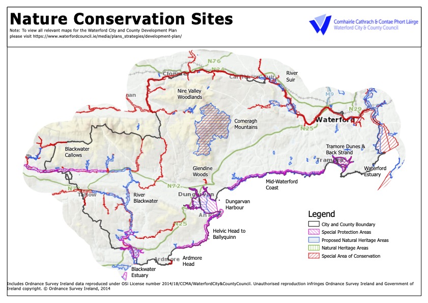
Figure 9.2 SACs and SPAs in Waterford
The Habitats Directive places an obligation on member states of the EU to establish an EU wide network of special conservation sites including Special Protection Areas (SPAs) and Special Areas of Conservation (SACs). This network is known as Natura 2000. SPAs and candidate SACs are designated by the National Parks and Wildlife Service of the DoEHLG. These sites must be managed to ensure maintenance or restoration of their favourable conservation status. There are nine SACs and six SPAs designated in County Waterford.
|
Table 9. 1 Special Areas of Conservations (SACs) |
|
|---|---|
|
Site Name |
Qualifying Interests of Site |
|
Ardmore Head |
Dry coastal heath and vegetated sea cliffs. |
|
Blackwater River (Cork/Waterford) |
Estuary, mudflats, shingle banks, salt meadows, floating river vegetation, old oak woods, alluvial woodland, Yew woodland, Freshwater Pearl Mussel, White-clawed Crayfish, Shad, Lamprey, Salmon, Otter, Killarney Fern |
|
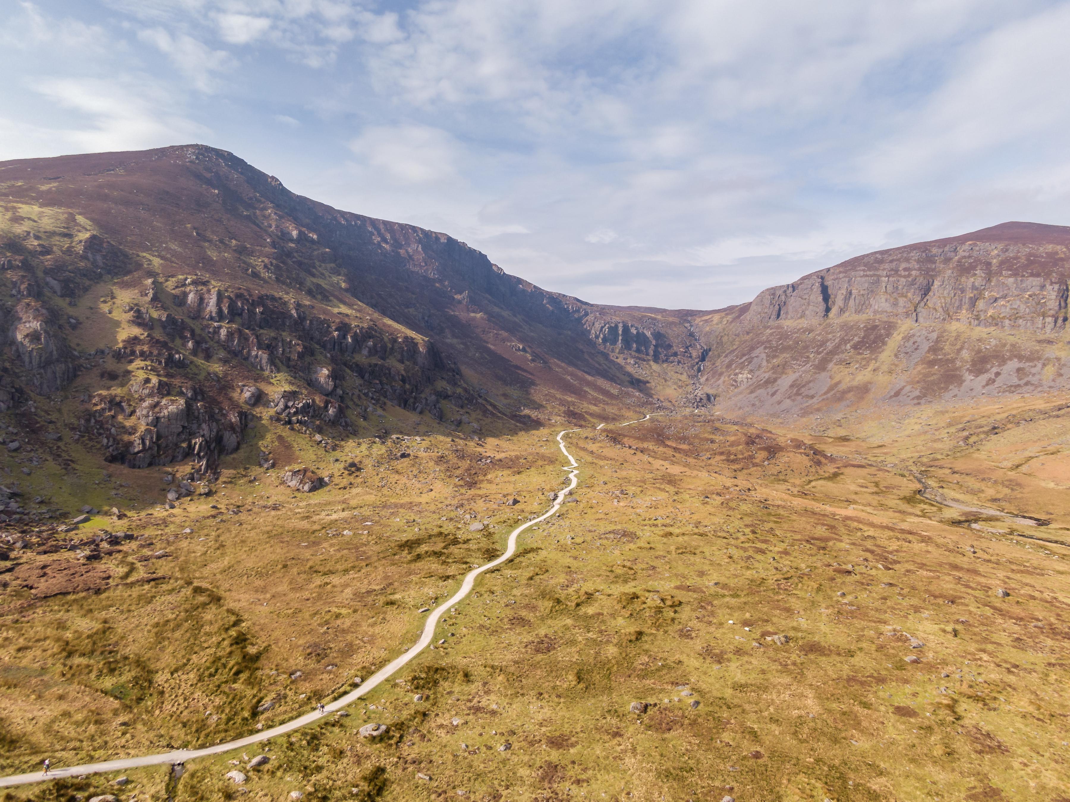
Comeragh Mountains |
Blanket bog, dry, wet and alpine heath, rocky slopes, oligotrophic lakes, floating river vegetation, Shining Sicklemoss. |
|
Glendine Wood |
Semi-natural woodland with rare assemblages of ground flora |
|
Helvick Head |
Vegetated sea cliffs and dry heath. |
|
Lower River Suir |
Salt meadows, floating river vegetation, marginal river vegetation, old oak woods, alluvial wet woodland, yew woods, Twaite Shad, Sea Lamprey, Brook Lamprey, River Lamprey, Freshwater Pearl Mussel, White-clawed Crayfish, Atlantic Salmon, Otter. |
|
Nire Valley Woods |
Old oak woodlands and dry heath. |
|
River Nore and River Barrow
(Waterford Estuary) |
Estuary, mudflats, salt meadows, floating river vegetation, dry heath, marginal river vegetation, petrifying springs, old oak woods, alluvial woods, White-clawed Crayfish, Freshwater Pearl Mussel, Whorl snail, Shad, Lamprey, Salmon, Otter, Killarney Fern |
|
Tramore Dunes and Back Strand |
Mudflats and sand flats, shingle banks, salt meadows, embryonic, white and fixed dunes. |
|
Table 9. 2 Special Protected Area (SPAs) |
|
|---|---|
|
Site Name |
Qualifying Interests of site |
|
Tramore Backstrand |
Brent Geese, Golden Plover, Grey Plover, Black-tailed Godwit, Bar-tailed Godwit, Lapwing, Dunlin, Sanderling. |
|
Dungarvan Harbour |
Great Northern Diver, Brent Goose, Black-tailed Godwit, Bar-tailed Godwit, of international importance. Nationally important numbers of Shelduck, Wigeon, Red-breasted Merganser, Grey Plover, Golden Plover, Lapwing, Knot, Sanderling, Dunlin, Redshank and Turnstone. |
|
Blackwater Callows |
Whooper Swan, Bewick’s Swan, Golden Plover, Kingfisher |
|
Blackwater Estuary |
Little Egret, Golden Plover, Bar-tailed Godwit, Sandwich Tern, Roseate Tern, Common Tern. |
|
Helvick Head Coast |
Peregrine, Chough, Herring Gull, Kittiwake |
|
Mid Waterford Coast |
Peregrine, Chough, Herring Gull, Cormorant |
9.8 Appropriate Assessment
Development proposed within or affecting European Sites (SACs and SPAs) will require screening for Appropriate Assessment, and if required Appropriate Assessment to determine if the proposed development is environmentally sustainable and to ensure it will not pose significant effects for the conservation objectives for the site and species or adversely affect the integrity of the area or its habitats or species. Where such a development would affect the integrity of a site, it will only be permitted where there is no alternative solution and there are imperative reasons of overriding public interest for the development or land-use change. Where the site concerned hosts a priority natural habitat type and/or a priority species, development or land use change will not be permitted unless it is necessary for imperative reasons of human health or public safety or for benefits of primary importance for the environment.
|
N2K Network Policy Objectives |
|
|---|---|
|
BD 04 |
Appropriate Assessment All projects and plans arising from this Plan[2] will be screened for the need to undertake Appropriate Assessment under Article 6 of the Habitats Directive. A plan or project will only be authorised after the competent authority has ascertained, based on scientific evidence, Screening for Appropriate Assessment, and subsequent Appropriate Assessment where necessary, that:
|
|
BD 05 |
Protection of European Sites Projects giving rise to adverse effects on the integrity of European sites (cumulatively, directly or indirectly) arising from their size or scale, land take, proximity, resource requirements, emissions (disposal to land, water or air), transportation requirements, duration of construction, operation, decommissioning or from any other effects shall not be permitted except as provided for in Article 6(4) of the Habitats Directive, viz. There must be a) no alternative solution available, b) imperative reasons of overriding public interest for the project to proceed; and c) Adequate compensatory measures in place. |
|
BD 06 |
Management Plans Article 6(1) of the Habitats Directive requires that Member States establish the necessary conservation measures for European sites involving, if need be, appropriate management plans specifically designed for the sites or integrated into other Development Plans. The Local Authority support the preparation and implementation of management plans for the conservation of Natura 2000 sites, pNHAs and Sites of Local Biodiversity as per appropriate. |
9.9 Natural Heritage Areas (NHAs) and Nature Reserves
There are 30 Natural Heritage Areas in Waterford City & County proposed for designation by the National Parks and Wildlife Service (NPWS) under the provisions of the Wildlife (Amendment) Act 2000 in recognition of nationally important habitats, species and sites of geological interest. Fenor Bog is also designated a Nature Reserve and is the only community owned Nature Reserve in the State. Figure 9.2 identifies the NHAs proposed for designation in Waterford.
|
Table 9. 3 Proposed Natural Heritage Areas (pNHAs) |
||||
|---|---|---|---|---|
|
Reference No. |
pNHA |
Reference No. |
pNHA |
|
|
1. |
Kilsheelan Lake |
15. |
Heilbhic Head |
|
|
2. |
Toor Wood |
16. |
Dungarvan Harbour |
|
|
3. |
Fiddown Island |
17. |
Stradbally Woods |
|
|
4. |
Nire Valley Woods |
18. |
Ballyvoyle Head to Tramore |
|
|
5. |
Comeragh Mountains |
19. |
Ballinlough |
|
|
6 |
Portlaw Woods |
20. |
Lissaviron Bog |
|
|
7. |
Coolfin & Darrigle Marshes |
21. |
Castlecraddock Fen |
|
|
8. |
Glenmore Woods |
22. |
Fenor Bog (NHA) |
|
|
9. |
Lismore Woods |
23. |
Carrickavrantry Reservoir & Marsh |
|
|
10. |
Blackwater Callows |
24. |
Islandtarsney Fen |
|
|
11. |
Blackwater River and Estuary |
25. |
Tramore Dunes & Backstrand |
|
|
12. |
Tallow Church of Ireland |
26. |
Belle Lake |
|
|
13. |
Ballyeelinan Wood |
27. |
Creadan Head |
|
|
14. |
Glen Anna Wood |
28. |
Dunmore East Cliffs |
|
|
29. |
Kilbarry/Ballinakill |
30. |
King’s Channel |
|
|
Biodiversity Assessment Policy Objectives |
|||||
|---|---|---|---|---|---|
|
BD 07 |
We will protect plant and animal species and habitats which have been identified by the EU Habitats Directive (1997), EU Bird Directive (1979), Wildlife Act (1976) and Wildlife (Amendment) Act 2000 and the Flora Protection Order (2015) and ensure development does not impact adversely on wildlife species or the integrity and habitat value of the site. |
||||
|
BD 08 |
We will assess all proposed developments at each level of the Development Planning process from City & County Development Plan, Local Area Plan to project level to determine potential for significant effects on the conservation objectives and /or adverse impact on the integrity of the Natura 2000 network and ensure that the requirements of Articles 6(3) and 6(4) of the Habitats Directive are fully satisfied. |
||||
|
BD 09 |
We will ensure a sufficient level of information is provided in development applications to enable a fully informed assessment of impacts on biodiversity to be made. Ecological impact assessments submitted in support of development proposals shall be carried out by appropriately qualified professionals and ecological survey work carried out at optimal survey time to ensure accurate collation of ecological data. |
||||
9.10 Local Sites of Biodiversity Value
Many habitats that do not meet the criteria for designations as an NHA are still important on a local or county basis and some sites may be of regional importance but have not been fully surveyed or recognised as such. In order to inform this process, Waterford City & County Council supports ongoing surveys of key habitats such as wetlands and other habitats and the development of a City & County Habitat map.
Article 10 of the EU Habitats Directive states that Member States shall endeavour in their land use planning and development policies, to encourage the management of features of the landscape, which are of major importance for wild flora and fauna. Such features are those which by virtue of their linear and continuous structures such as rivers and riverbanks or hedgerows or by virtue of their functions as stepping-stones such as ponds or small woods are essential for the migration, dispersal and genetic exchange of wild species.
|
Sites of Biodiversity Value Policy Objectives |
|
|---|---|
|
BD 10 |
We will prevent unnecessary fragmentation and promote integration of existing green infrastructure such as trees, woodlands, hedgerows, earth banks and wetlands in the design of new development. Proposed development will be encouraged to retain and create green corridors within and between built up urban areas along with areas that are not subject to public access so as to promote wildlife habitat value. |
|
BD 11 |
We will mitigate potential adverse impacts on existing biodiversity and green infrastructure in development proposals through requirement for biodiversity enhancement measures such as habitat creation, pollinator friendly landscaping schemes and or nesting boxes for pollinators, birds and mammals. |
|
BD 12 |
We will continue to develop the broader network of habitats through habitat mapping and management planning in collaboration with other agencies to record the range of habitats and network of ecological corridors and integrate this information in the Development Planning process. |
|
BD 13 |
We will prevent unnecessary noise and light disturbance to wildlife habitats and species by requesting Noise Impact Assessments and Lighting Plans to support development proposals so that wildlife friendly lighting specifications and avoidance of unnecessary noise are incorporated in early design stage of development schemes. |
|
BD 14 |
To promote sustainable and creative proposals in lighting and display technologies. All external lighting should be down lighting and should be time limited where possible. Lighting should be avoided in sensitive wildlife areas and light pollution avoided. All external light proposals should be accompanied by a light pollution study and deviations to the objective will only be considered where the applicant can clearly show that the proposed light solution would result in a more sustainable solution. |
9.11 Wetlands
Wetlands are areas of marsh, fen, peat land or water, whether natural or artificial, permanent or temporary, with water that is static or flowing. Wetlands are significant habitats in County Waterford and much work has also been carried out on Integrated Constructed Wetlands in the Anne Valley. Wetlands provide habitats for communities of species that can survive in aquatic and semi-aquatic conditions. The amount of drainage and water present are their most important feature as increased drainage or flooding can cause significant change in habitat value and species diversity. The Water Framework Directive and Ramsar Convention provide for the protection and wise use of Wetlands. A total of 45 sites have been identified as Ramsar sites in Ireland. These are wetlands that are of significant value for nature. There are two Ramsar Sites in Co. Waterford - Dungarvan Harbour and Tramore Bay.
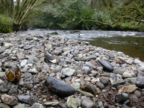
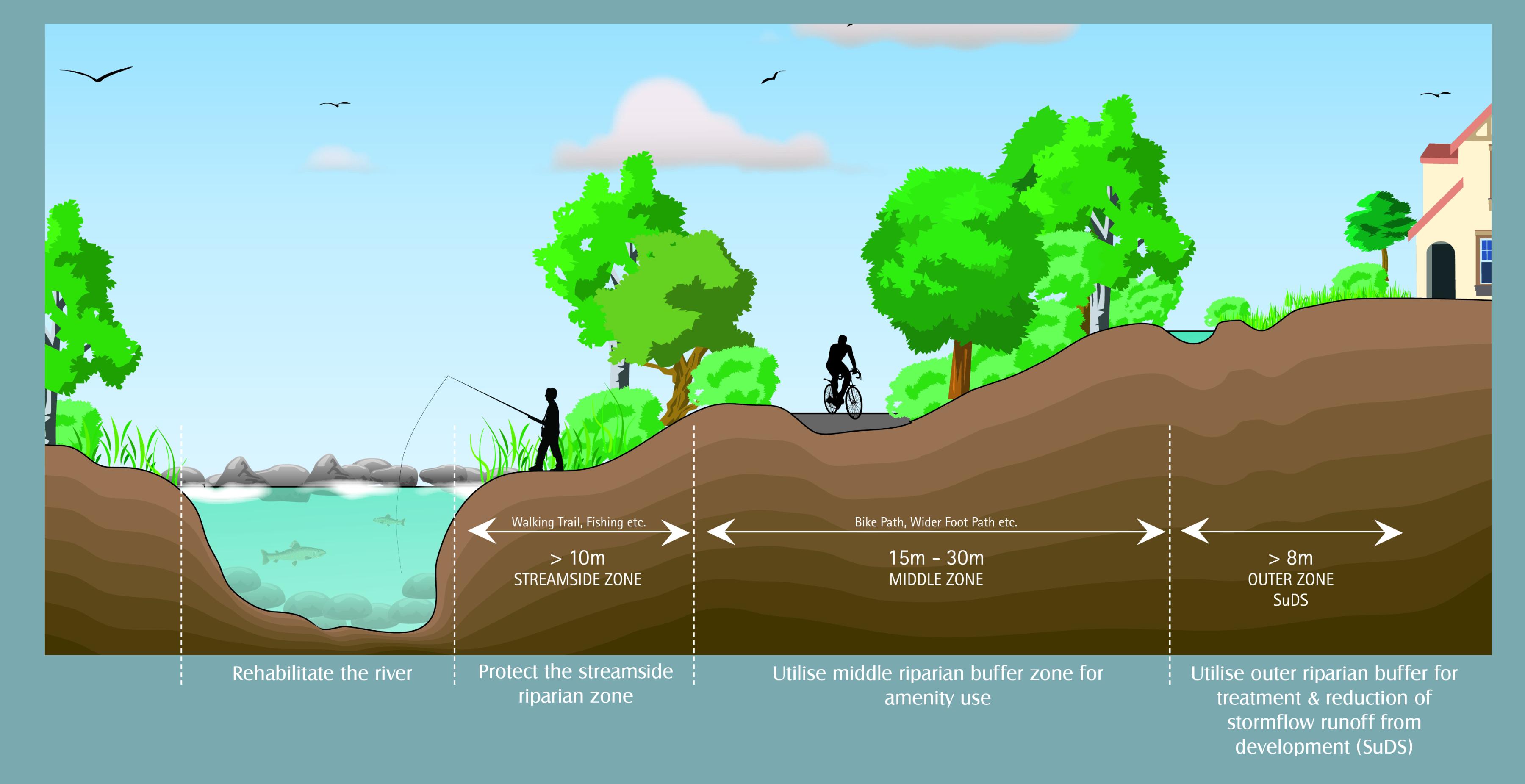
There are around 300 wetlands for local biodiversity interest in Waterford and surveys of these sites were carried out in 2006, 2015 and 2021. These wetlands of local biodiversity importance are listed in Appendix 11. A key feature of the Waterford landscape is the range of watercourses from large rivers such as the Blackwater, Colligan, Tay, Mahon and Suir to smaller rivers and streams. Along with recreational benefits these watercourses provide habitat for a number of important and protected species such as Crayfish, Shad, Lamprey, Salmon and the Freshwater Pearl Mussel. Smaller rivers and streams may be valuable as spawning grounds. It is important that all watercourses and their associated riparian habitats are maintained in a semi-natural condition as far as possible. Maintenance of good water quality requires protection of the wider aquatic environment including the associated riverbank and an appropriate ecological buffer zone to support maintenance of the physical habitat and hydrological processes. The Council will consult with Inland Fisheries Ireland on developments that may impact on watercourses and take account of Requirements for the Protection of Fisheries Habitat during Construction and Development Works at River Sites.
|
Wetland Policy Objectives |
|
|---|---|
|
BD 15 |
We will ensure that Waterford’s floodplains, wetlands and watercourses are retained for their biodiversity and flood protection values and maintain good ecological status of wetlands and watercourses in support of the provisions of the Water Framework Directive and Ramsar Convention. |
|
BD 16 |
We will protect wetland sites listed in Appendix 11 and other wetlands that may be identified of biodiversity value from infilling and other developments that may affect the biodiversity value of these sites. |
|
BD 17 |
The preservation of riparian corridors is a requirement for the protection of aquatic habitats and facilitation of public access to waterways. Development proposals will be required to avoid culverting of river channels while maintaining a buffer zone of at least 15m between the development works and the top of the riverbank. We will consult with Inland Fisheries Ireland and LAWPRO on the establishment and protection of riparian habitats where appropriate. |
|
BD 18 |
Drainage or Reclamation of Wetlands We will implement the relevant parts of the Planning and Development (Amendment) (No. 2) Regulations 2011 and the European Communities (Amendment to Planning and Development) Regulations 2011, which require planning permission to be applied for where the area impacted by works relating to the drainage or reclamation of a wetland exceeds 0.1 hectares or where such works may have a significant effect on the environment. Such applications for permission would need to be supported by an Appropriate Assessment where necessary. |
|
BD 19 |
Peatlands We will support the implementation of any relevant recommendations contained in the National Peatlands Strategy 2015. Developments sited on peatlands have the potential to increase overall carbon losses, potentially undermining expected carbon savings (in the case of renewable energy developments) and damaging rare habitats of European importance. It is recommended that when developing project proposals for developments on peatlands assessments are undertaken that consider:
|
9.12 Hedgerows
Hedgerows are a distinctive feature of the Waterford landscape providing wildlife habitats, attractive scenery and shelter in exposed areas. They represent the single most significant habitat supporting plants, invertebrates, birds and mammals in County Waterford. The value of hedgerows as a habitat is dependent on both the quality and condition of the hedgerow and its linear integrity. The linear integrity or connectivity of the hedgerow in effect acts as a green corridor connecting larger habitats and enhancing the biodiversity of both the hedgerow and the larger habitats.
In addition to the biodiversity value of hedgerows, there are broader benefits including retention of surface water run-off from land reducing the flood risk downstream, prevention of soil erosion and reduced risk of disease transmission between farms. They also function as carbon sinks, pollution filters and sound barriers between busy roads and housing developments. The loss of a section of hedgerow may have a significant environmental impact. It is therefore in our common interest to preserve and enhance hedgerows throughout the City & County.
The greatest threats to hedgerow habitat are inappropriate maintenance by cutting too severely and preventing flowering or cutting at the wrong time of year and introduction of breaks in the linear integrity from new development. It is the policy of Waterford City & County Council to retain the natural roadside hedgerows as far as possible for the purposes of maintaining natural habitat, landscape character and screening of new developments. The Council will also seek to ensure that all new development includes measures to preserve the linear integrity and enhance the quality of hedgerows.
Development standards for hedgerow replacement are set out in Volume 2 including a list of shrub and tree species suitable for planting according to topographical feature and geographic location within the county. Plants of local provenance and that support pollinating species shall be prioritised in landscaping schemes.
|
Hedgerow Policy Objectives |
|
|---|---|
|
BD 20 |
To protect hedgerows in all new developments, particularly species rich roadside and townland boundary hedgerows, such features should be incorporated into the open space provisions at the concept design stage. There will be a presumption against the removal of hedgerows however where their removal is unavoidable replacement planting shall involve establishment of new hedgerows with native species of local provenance and that support pollinating species. |
9.13 Trees and Woodlands
Trees are a valuable feature of the landscape for their amenity and wildlife value and Waterford has one of the highest levels of tree cover in the State. The 2008 NPWS Native Woodlands Survey reports there are 6,990 ha of native woodland in Waterford representing 3.8% of the County land cover.
In recognition of their landscape value some trees are protected under Tree Preservation Orders (TPOs). These are listed in Appendix 11. The Tree Register of Ireland maintains a register of champion trees and lists over 270 champion trees for County Waterford by virtue of their age, height and girth. Many of these trees are found within demesne landscapes which covered a significant area of land cover in the County in the past.
Under, Section 19 of the Forestry Act 2014, with certain exceptions, it is illegal to uproot a tree over ten years of age or cut down a tree of any age unless notice of intention to do so has been given in accordance with the Forestry Act. With the exception of an area located within the boundaries of a town or borough council area, a tree within 30m of a building or tree stands within 10m of a public road, a tree felling licence from the Forest Service of the Department of Agriculture and Food is required if it is proposed to fell trees. An exemption for a felling licence does not apply to a tree(s) within the curtilage or attendant grounds of a protected structure under Part IV of the Planning and Development Act 2000 (as amended).
|
Trees & Woodlands Policy Objectives |
|
|---|---|
|
BD 21 |
We will preserve and enhance the amenity and biodiversity value of the County and City by preserving as far as possible trees, woodlands and hedgerows and will consider Tree Preservation Orders in order to protect trees of significance throughout the City and County. Existing TPOs are listed in Appendix 11. Trees of Special Amenity Value are also listed in Appendix 11. |
|
BD 22 |
To implement the Waterford City and County Tree Management Strategy 2021 and review as appropriate. |
|
BD 23 |
Where development proposals require felling of mature trees a comprehensive tree survey carried out by a suitably qualified arborist shall be submitted assessing the condition, ecological and amenity value of the treestock proposed for removal and mitigation planting and management scheme. We will seek in all cases to ensure when undertaking development or when permitting development that the loss of or damage to existing trees is minimised. |
|
BD 24 |
To ensure when planning to undertake development or when considering the approval or authorisation of development that adequate information to assess the impact of the proposed development on existing trees, including tree surveys and planting and management schemes, is provided and that the protection, preservation and management of existing trees of amenity value, and the implementation of a planned planting and management scheme, are provided for. |
|
BD 25 |
We will continue to enhance our public realm and general amenity of the City and County through the continued maintenance and provision of trees in the urban environment with a view to providing continuity of tree cover where possible throughout our urban centres and promoting the use of native species where possible, with varied species and age distribution. |
|
BD 26 |
We will carry out an audit of all trees of special amenity value and TPOs, as listed in Appendix 11, with a view to updating same. |
9.14 Forestry
Forestry provides benefits for the local economy, amenity and carbon sequestration which is significant at a time where reduction of carbon emissions is a priority. Approximately 22% of County Waterford is covered by coniferous forest plantations. Coillte manage 15% of the County while the remainder is in private ownership.
National Forestry policy is based on The Forest Strategy published in 2022 under Project Woodland established in 2021 to bring a new impetus to woodland creation in Ireland and building on the previous strategy Growing for the Future (1996). The National target is to establish a forestry cover of 17% or 1.2 million ha by 2030. The 2000 CAP Rural Development Plan set the target of broadleaf planting of total afforestation to 30%, a target which is also supported by the National Biodiversity Plan 2002.
Currently, Ireland has approximately 10.5 % of land cover devoted to forestry compared to the EU average of approximately 40% and where on average 60% of all trees planted are broadleaves. Afforestation is carried out in accordance with Sustainable Forest management and 15% of all afforestation areas must be managed with particular regard to Biodiversity. Coillte manage 5 forest amenity areas in the County: Colligan, Dromana, Faithlegg, Glenshelane and Kilclooney.
Given the need to restructure agricultural practices, the Council will support the development of forestry, particularly deciduous forestry and Biomass as an alternative agricultural land use.

|
Forestry Policy Objectives |
|
|---|---|
|
F 01 |
We will encourage the replanting and extension of woodland cover, in particular mixed forests and broadleaf forests, in order to ensure the preservation and enhancement of the arboreal landscape in the County |
|
F 02 |
We will support the economic, recreational and carbon sequestration potential of forestry. Forestry as a land use and its ancillary development will be encouraged in appropriate locations subject to such development not impacting on biodiversity/protected species such as Freshwater Pearl Mussel, interfering with significant views or prospects or being unduly obtrusive in the landscape. |
|
F 03 |
We will promote a greater mix of species in Forestry Plantations and to encourage greater structural and spatial diversity in plantation design and enhanced biodiversity and habitat value. We will facilitate afforestation in appropriate locations in co-operation with the Forest Service and Coillte and in accordance with the principles of Sustainable Forest Management codes of best practice and the Waterford Climate Adaptation Strategy and updates of these. |
|
F 04 |
We will co-operate with landowners, Coillte and the Forest Service in promoting greater public access and recreational use of state and privately owned forests in Waterford. |
|
F 05 |
To ensure that linear felling of trees is not encouraged in exposed or scenic areas and also promote phased rather than clear felling. |
9.15 Invasive Species
Many species of flora and fauna have been introduced to Ireland and pose a serious threat to native vegetation, wildlife and their ecosystems. Problematic species in Waterford include Grey Squirrel, Japanese Knotweed and Himalayan Balsam. Advice on the distribution, threat status and control of invasive species is available on the National Biodiversity Data Centre’s Website[3] . A useful guidance document relating to the management of invasive species is the NRA’s Guidance on The Management of Noxious Weeds and Non-Native Invasive Plant Species on National Roads (2006)[4].
|
Invasive Species Policy Objectives |
|
|---|---|
|
BD 28 |
We will support, as appropriate, the National Parks and Wildlife Service’s efforts to seek to control and manage the spread of non-native invasive species on land and water. Where the presence of non-native invasive species is identified at the site of any proposed development or where the proposed activity has an elevated risk of resulting in the presence of these species, details of how these species will be managed and controlled will be required. Where development is approved for sites containing known invasive species, we will consider, where appropriate, the use of conditions for control and removal of invasive species. |
|
BD 29 |
We will promote awareness of invasive species and appropriate management, and work with other agencies to address the issue. |
[1] Remediation measures are identified for -Clodiagh, John’s River, Tay, Colligan-Bricky-Dungarvan Harbour, Dunhill, Glenaboy, Licky
[2] Such projects include but are not limited to those relating to: agriculture; amenity and recreation; contaminated sites; electricity transmission; flood alleviation and prevention; forestry; mineral extraction; renewable energy projects; roads; telecommunications; tourism; wastewater and discharges; and water supply and abstraction.
[3] https://species.biodiversityireland.ie/?keyword=Invasive%20Species%20Of%20Union%20Concern
[4] https://www.tii.ie/technical-services/environment/construction/Management-of-Noxious-Weeds-and-Non-Native-Invasive-Plant-Species-on-National-Road-Schemes.pdf