I would be grateful if the attached site (Folio number WD35008F) could be considered for re-zoning in the new Waterford City and County Development Plan for the period 2022-2028.
Map 6: Miscellaneous map
Closed18 Jun, 2021, 11:00am - 30 Aug, 2021, 5:00pm
Map 6: Miscellaneous Map
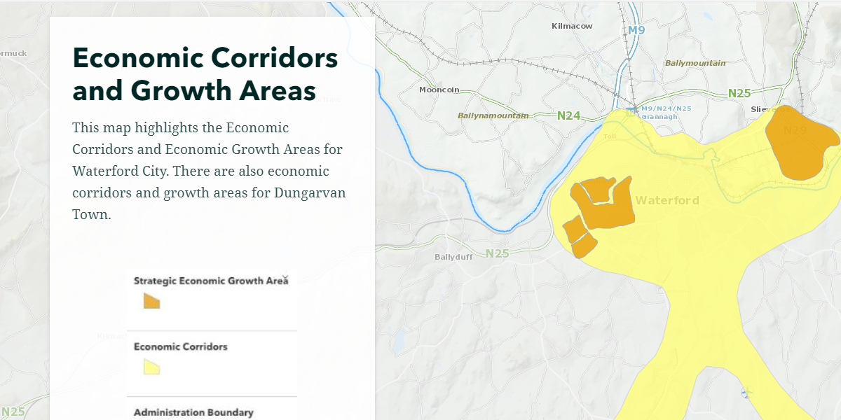
This map shows Waterford’s Miscellaneous Map. The data contained in the map is as follows:
- Economic Corridors and Growth Areas;
- North Quay SSZ;
- Waterford City Decarbonising Zone and HSA Seveso Site;
- Retail Core Shopping Areas;
- Rural Economic Clusters and proposed Green Links; and
- The Rural housing Classification.
Click here to view map
Contents
Observations
Observations
I reside in [Redacted Personal Information]. I along with my neighbour built 3 houses on a site that was in a flood zone with the understanding that if we built as per our planning permission the...